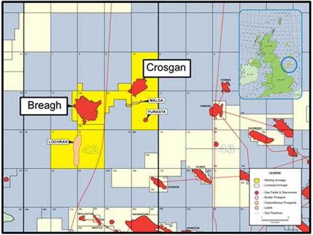
Working with GeoPartners Ltd, UAE seismic survey company Polarcus has acquired 1,460sq.km of high density broadband multi-client 3D seismic data across the north of Quad 42 in the UK Southern North Sea.
The purpose of the North Breagh survey is to build a detailed picture of the prospectivity of Zechstein and pre-Zechstein sediment plays in an area where previous studies have mapped a number of structural leads.
Until the early 1990s, the limited drilling over the northern part of Quadrant 42 was mainly focused on the Triassic Bunter play with simple dip-closures over Zechstein salt swells.
Only a single, small and non-commercial gas discovery was made during this exploration phase with well 42/15b-1.
Exploration focus shifted during the early 1990s to the Carboniferous play, with several deep exploration wells drilled in Quadrants 41, 42 and 43 on large fault block and dip-closed anticlines.
This drilling phase confirmed the development of a major uplifted arch running NE-SW across the northern part of Quadrant 42.
Drilling also demonstrated the presence of a thick fluvio-deltaic to shallow marine Lower Carboniferous section.
With optimum reservoir quality seen in some extensive Carboniferous sandstones, for example the Fell, Whitby, Rough Rock and Crawshaw sandstones, the ability to identify and map these sand bodies from seismic would significantly reduce the reservoir and potentially topseal (trap) risk.
The view is that the ability to map local Rotliegendes sand “thicks”, and Z2/Z3 carbonate mounds and reefs, would also enhance the ability to investigate the prospectivity above the base Permian.
According to Polarcus, with the presence of mature source rocks demonstrated across the area (with the large and subsequently developed Breagh, plus Crosgan structures full to spill) the exploration challenge in Quadrant 42 lies with identifying and exploiting such permeable reservoir facies, and with defining timely structures with valid top-seals.
Previous studies have mapped a number of structural leads at Base Permian level and the new data covers a number of open prospective blocks.
Firming up many of these plays into drillable prospects has not been possible to date with the existing seismic data due to imaging problems caused by the complex (geological) “overburden”.